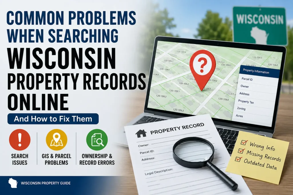
Looking up property records online sounds easy until you actually need something important.
Maybe you are trying to confirm a property line before installing a fence. Maybe you found land for sale and want to check zoning rules before making an offer. Or maybe you simply want to verify who owns a neighboring parcel because something about the listing does not feel right.
Most people expect a quick search.
Type the address. Click the property. Get the answers.
But that is rarely how it goes.
Instead, users across Wisconsin often run into confusing parcel numbers, outdated ownership records, missing zoning information, broken county search tools, or GIS maps that do not seem to match the land itself. Sometimes the same property appears differently across multiple county systems. Other times, the property does not appear at all.
And honestly, some county websites feel like they were designed years ago and never simplified for normal users.
That frustration is more common than most people realize.
The confusing part is that many users assume they are doing something wrong. In reality, Wisconsin property records are spread across different county departments, mapping systems, assessor databases and deed records that do not always update together.
Understanding where these problems come from and how experienced buyers, homeowners and researchers work around them can save you from expensive mistakes later.
Especially when property boundaries, zoning restrictions, taxes, or land ownership are involved.
What Are Wisconsin Property Records?
Wisconsin property records are public records connected to land ownership and property identification. Most counties provide online access to at least part of this information through county property lookup systems or GIS parcel viewers.
Depending on the county, you may find:
- property ownership records
- parcel identification numbers (PINs)
- assessed values
- tax history
- Wisconsin GIS property maps
- deed references
- zoning classifications
- lot dimensions
- aerial imagery
- land use details
These systems are commonly maintained by separate county offices, including:
- assessor departments
- GIS mapping divisions
- Register of Deeds offices
- land information departments
- zoning and planning offices
That separation matters more than people think.
A homeowner may look at one county map showing updated parcel boundaries while another county database still displays older ownership information. Both records technically belong to the same property, but they may not refresh at the same time.
That is where a lot of confusion begins.
Why Wisconsin Property Record Searches Become So Confusing
There is no single statewide Wisconsin property database that handles everything in one place.
Every county builds its own system differently.
Some counties have modern GIS parcel viewers with aerial imagery, zoning overlays, mobile-friendly search tools, and detailed tax parcel information. Others still rely on older platforms that can feel clunky even on desktop computers.
A person searching property records in Dane County may have a completely different experience from someone researching land in Brown County or Racine County. Even the terminology changes between counties.
One system may use:
- parcel ID
while another says:
- tax key number
- parcel number
- PIN
- tax parcel ID
To county employees, those labels make sense.
To everyday users? Not always. And then there is the GIS issue.
A surprising number of homeowners assume GIS parcel lines are legally exact because they look precise on screen. Zoom in close enough and the lines almost feel official. But GIS maps are still reference tools, not legal surveys.
That misunderstanding causes real problems later especially with fences, driveways, sheds and construction planning.
Common Problems People Face When Searching Wisconsin Property Records
The Property Address Does Not Appear Anywhere
This frustrates people immediately. You enter the address carefully. Nothing appears.
Then you try again with different spacing. Still nothing.
In many Wisconsin counties, address formatting is inconsistent especially in rural areas where roads may use abbreviations, older route systems, or alternate naming styles.
For example:
- County Highway B
- County Rd B
- CTH B
- CTY HWY B
could all refer to the same location. Newer homes sometimes create additional problems because county systems may not fully update immediately after construction or subdivision changes.
There are also cases where mailing addresses differ from official parcel site addresses. That catches people off guard all the time.
Quick Tip
If an address search fails repeatedly, try:
- parcel number searches
- owner name searches
- nearby parcel map browsing
- shortened street formats
Oddly enough, searching less information sometimes works better.
Parcel Numbers Feel Impossible to Understand
Parcel identification numbers confuse almost everyone at first. And honestly, that reaction makes sense.
Some Wisconsin parcel numbers look like random strings of digits and dashes with no obvious meaning. Others contain township references, subdivision identifiers, or formatting styles unique to a specific county.
People often ask:
“Why does one property have multiple parcel numbers?”
That usually happens because:
- land was split previously
- multiple lots were combined
- condo units share master parcel structures
- tax records and GIS systems use slightly different IDs
The confusion becomes worse when buyers start comparing records across:
- assessor systems
- GIS parcel viewers
- tax databases
- deed filings
The same property can appear slightly differently in each place. Not because the records are fake because the systems were built for different purposes.
Ownership Information Looks Outdated
This creates a lot of distrust during property research. A person buys land. Weeks later, county records still show the previous owner online.
Naturally, people wonder:
“Did the sale actually go through?”
Usually, yes.
The delay happens because Wisconsin property information updates through multiple departments at different times.
A deed may already be recorded with the Register of Deeds office while:
- assessor systems still show older ownership
- GIS databases have not refreshed yet
- tax records remain tied to previous billing cycles
Some counties update quickly. Others move slower.
And during busy transfer periods, records can lag longer than users expect. That delay is frustrating, but it is not unusual.
Real-World Observation
People often assume online ownership records update instantly like banking apps or shipping trackers. County property systems do not work that way.
Many still depend on manual review, scheduled data syncing, or department-by-department updates.
GIS Property Lines Don’t Match What You See on the Ground
This is probably one of the biggest misunderstandings in online property research.
A homeowner opens a Wisconsin GIS property map and sees clear parcel lines crossing the land. The map looks official. Accurate. Precise. So naturally they trust it.
Then later:
- a fence placement gets disputed
- a driveway crosses an easement
- a shed ends up too close to a setback line
- neighboring owners disagree on boundaries
And suddenly everyone discovers the GIS map was only approximate.
This happens more than people think.
Aerial imagery creates even more confusion because visible landmarks — fences, trees, gravel paths, landscaping rarely line up perfectly with GIS parcel boundaries.
Some homeowners discover their fence has been several feet off the expected property line for years.
Not because they ignored the boundary intentionally. Because they trusted a visual map that looked legally exact.
Important Note
Wisconsin GIS parcel viewers are excellent research tools, but they should never replace professional land surveys when legal boundaries truly matter.
That distinction matters most during:
- construction projects
- fence installations
- land sales
- disputes with neighbors
- permit applications
Zoning Information Can Be Surprisingly Difficult to Interpret
Zoning sounds simple until you actually try reading zoning maps.
Most county GIS systems use layers, color overlays, abbreviations, and planning codes that make perfect sense to zoning departments but not always to regular users.
A parcel may display labels such as:
- R-1
- A-2
- C-3
- RR
- M-1
Without context, those codes mean almost nothing to most buyers. And the problem is not just understanding the code itself.
Users also struggle with:
- missing zoning legends
- outdated overlays
- environmental restrictions
- shoreland limitations
- floodplain layers
- overlapping zoning districts
Sometimes the property “looks” usable for a certain purpose while zoning rules quietly prohibit it. That disconnect causes expensive misunderstandings.
A small business owner might purchase land assuming a café or workshop is allowed because neighboring buildings appear commercial.
Later they discover the parcel is still zoned residential. Now permits, approvals, or rezoning requests become part of the process. That changes everything.
Some County Websites Are Simply Hard to Use
There is no polite way around this.
Some county property systems genuinely feel outdated. Not all of them. But enough that users notice.
You may click through:
- multiple disconnected portals
- confusing menus
- old search interfaces
- broken map layers
- PDF-heavy pages
- tiny mobile buttons
And sometimes important information is spread across entirely different systems.
For example:
- GIS parcel maps on one site
- tax records somewhere else
- deed documents in another portal
- zoning maps on a planning department page
Users end up jumping between tabs trying to piece together information that feels like it should already exist in one place.
This becomes especially frustrating for:
- first-time homebuyers
- older homeowners
- non-technical users
- people researching property quickly during negotiations
It is not that the information is unavailable. It is that the systems often prioritize administration over usability.
Property Tax Information Often Confuses Buyers
A lot of users mistakenly assume:
assessed value = market value
But county assessments and real-world sale prices are not always aligned.
A Wisconsin property may:
- sell for far above assessment value
- still display older assessments online
- include exemptions affecting taxes
- update annually instead of immediately
During changing housing markets, these differences become even more noticeable.
This creates confusion for:
- buyers comparing listings
- investors estimating value
- homeowners reviewing taxes
And honestly, online property systems do not always explain the difference clearly enough.
Duplicate Property Results Create More Confusion
This issue appears often with:
- condominiums
- subdivisions
- apartment parcels
- multi-lot land
- shared addresses
Users may see several similar records and accidentally review the wrong property.
A condo building, for example, may contain:
- one master parcel
- multiple unit parcels
- shared tax structures
- association-linked records
Without experience using county parcel systems, it becomes easy to confuse one unit or lot with another.
Why These Problems Matter More Than Most People Expect
At first, these may sound like small technical annoyances. But property misunderstandings become expensive very quickly.
Incorrect assumptions can lead to:
- fence disputes
- denied permits
- construction delays
- zoning violations
- easement conflicts
- purchase mistakes
- inaccurate land valuations
A buyer researching vacant land may think:
“This looks fine.”
But missing one zoning overlay or easement note could completely change how usable that property actually is.
That is why experienced investors, contractors, surveyors, and real estate professionals rarely trust a single source alone.
They compare:
- Wisconsin GIS property maps
- assessor property searches
- deed records
- zoning documents
- parcel viewer layers
- county planning information
The more important the decision, the more verification matters.
How to Search Wisconsin Property Records More Accurately
Start With County GIS Maps
GIS parcel viewers are usually the best starting point because they visually combine:
- property boundaries
- aerial imagery
- zoning layers
- road access
- parcel dimensions
- nearby land information
For general research, they are incredibly useful. Especially when comparing multiple properties side by side.
If your website has a Wisconsin GIS Maps guide, this is the perfect place to internally link it naturally.
Use Parcel Numbers Whenever Possible
Addresses change more often than people realize. Parcel numbers usually stay more consistent.
Searching by parcel ID instead of street address helps reduce:
- formatting problems
- duplicate results
- rural addressing confusion
- subdivision inconsistencies
This small change alone solves many failed property searches.
Cross-Check GIS Data With Tax Records
Do not rely on only one system. A smart property search usually involves comparing:
- GIS parcel viewers
- tax assessment databases
- ownership records
- zoning maps
This helps spot:
- outdated ownership data
- parcel mismatches
- acreage inconsistencies
- zoning conflicts
Experienced buyers cross-check constantly.
Verify Ownership Through Register of Deeds Records
When ownership information matters legally, deed filings matter more than general map displays.
This is especially important after:
- recent sales
- inheritance transfers
- land splits
- title corrections
If your site contains a Wisconsin property ownership guide or deed records article, linking it here strengthens topical authority naturally.
Contact County Offices for Important Questions
Online systems cannot explain everything. Sometimes the fastest way to solve confusion is speaking directly with:
- assessor offices
- zoning departments
- land information offices
- Register of Deeds staff
Especially when:
- permits are involved
- boundaries are disputed
- zoning seems unclear
- property records conflict
Human clarification still matters. A lot.
Wisconsin Counties Where Property Searches Are Most Common
Many Wisconsin property searches happen in counties such as:
- Milwaukee County
- Waukesha County
- Dane County
- Brown County
- Racine County
Each county organizes parcel searches, tax records, GIS layers, and zoning systems differently, which is one reason user experiences vary so much across Wisconsin.
GIS Maps vs Official Property Records
| GIS Maps | Official Property Records |
|---|---|
| Visual land reference | Legal documentation |
| Approximate parcel boundaries | Recorded ownership information |
| Helpful for planning | Used for legal verification |
| Interactive mapping tool | Official county filing system |
| Useful for research | Required for formal accuracy |
A GIS map may help you understand where a parcel sits.
But legal ownership, deed transfers, easements, and exact boundaries still depend on official documentation and surveys. That distinction matters.
Tips to Avoid Mistakes When Researching Wisconsin Property Online
- Always compare multiple property sources
- Do not assume GIS lines are exact surveys
- Check when county data was last updated
- Review zoning layers carefully
- Use parcel IDs instead of only addresses
- Verify ownership through deed records
- Confirm important details directly with county offices
- Be cautious with recently sold properties
- Compare aerial imagery with parcel overlays
- Use professional surveys for legal boundary certainty
Most expensive property mistakes start with assumptions. Careful verification prevents many of them.
Frequently Asked Questions
Are Wisconsin property records free to search?
Most Wisconsin counties provide free online access to property lookup systems, parcel viewers, GIS maps, and tax assessment databases.
Are Wisconsin GIS property lines legally accurate?
No. GIS maps are reference tools and should not replace professional land surveys for legal boundary verification.
Why can’t I find my property online?
Address formatting issues, rural naming differences, recent parcel changes, and delayed county updates commonly affect search results.
How often are Wisconsin property records updated?
Update schedules vary by county and department. Some systems refresh daily, while others update more slowly depending on record type.
Can online zoning information be wrong?
Sometimes zoning layers lag behind official planning updates or require interpretation from local zoning offices.
What is the difference between GIS maps and assessor records?
GIS maps visually display land and parcel information, while assessor systems primarily focus on taxation, ownership, and property assessment data.
Final Thoughts
Wisconsin property records are incredibly useful once you understand how the systems actually work.
The problem is not that county property data is unavailable.
The problem is that many users expect everything to be centralized, perfectly updated, and easy to interpret immediately.
In reality, Wisconsin parcel searches often involve multiple systems:
- GIS parcel viewers
- assessor databases
- zoning maps
- tax records
- deed filings
- county planning departments
And those systems do not always align perfectly.
The people who avoid costly property mistakes are usually the ones who slow down, compare multiple sources, and verify important details before making decisions.
Whether you are researching land boundaries, zoning restrictions, ownership history, or tax parcel information, combining GIS tools with official county records provides a much clearer picture than relying on a single search result alone.